Vista de mapa de esquí
Resumen
El complemento de vista de mapa de esquí de OsmAnd muestra pistas famosas y populares, áreas de esquí oficialmente aprobadas y mapas de senderos de la mayoría de las estaciones de esquí. Los mapas de pistas de OpenStreetMap son la fuente de datos para los mapas de esquí de OsmAnd. Combinando mapas vectoriales con mapas ráster, el mapa de esquí de OsmAnd es muy preciso y será útil para instructores, escaladores y entusiastas de los deportes de invierno.
El mapa de esquí de OsmAnd es parte de los mapas vectoriales y no requiere descargas adicionales. Está deshabilitado por defecto. El mapa de esquí de OsmAnd es uno de los Estilos de mapa que proporciona características adicionales al resaltar algunos objetos y hacer otros menos visibles.
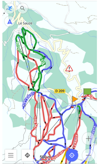
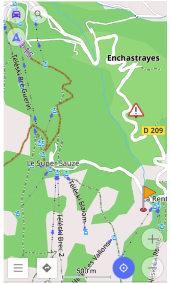
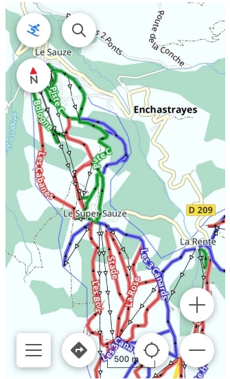
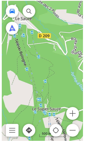
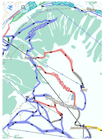
A continuación se muestran dos perfiles: el de la izquierda es para esquiar y el de la derecha para conducir. El perfil de Esquí resalta senderos, vías aéreas, colores de invierno y todos los objetos del mapa útiles para navegar en el área de esquí.
- Android
- iOS
Parámetros de configuración requeridos
La siguiente configuración hace que el mapa de esquí de OsmAnd aparezca en la pantalla:
- Habilite el complemento de vista de mapa de esquí.
- Establezca el estilo de mapa Invierno y Esquí para el perfil requerido.
- Si es necesario, combine mapas.
Establecer estilo de mapa de invierno y esquí
- Android
- iOS
Vaya a: Menú → Configurar mapa → Renderizado del mapa → Estilo del mapa → Invierno y esquí
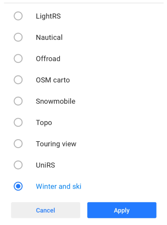
Vaya a: Menú → Configurar mapa → Tipo de mapa → Estilos de mapas sin conexión → Activar estilo del mapa a esquí
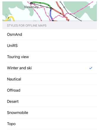
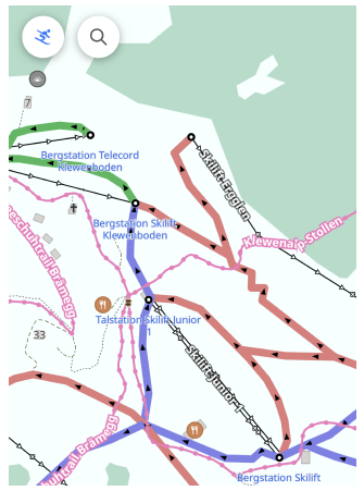
El estilo de mapa de invierno y esquí resalta senderos, rutas de esquí de travesía, pistas de trineo e información relacionada con el invierno y el esquí. Para mostrar el estilo en el mapa, debe realizar las siguientes configuraciones:
- Seleccione el perfil requerido.
- Abra Configurar mapa.
- Desplácese hacia abajo hasta Estilo de mapa/Tipo de mapa, ábralo y marque Invierno y Esquí.
El perfil de Esquí está diseñado para usarse en combinación con los estilos de Invierno y Esquí. However, the navigation type for each specific profile can be changed and set individually, so the final configuration of the profile, map style, and navigation completely depends on your settings.
Combinar mapas
- Android
- iOS
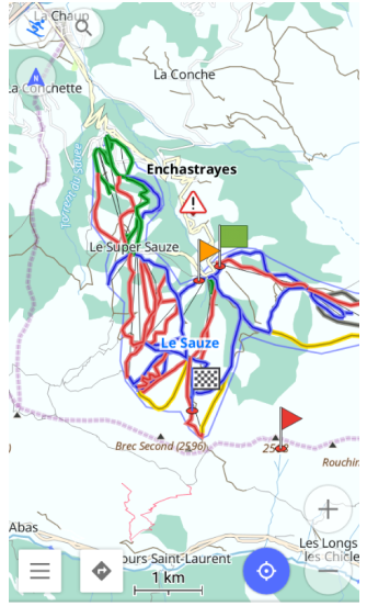
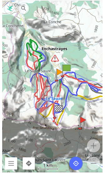
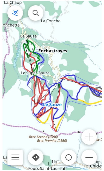
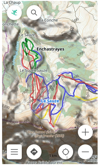
El mapa vectorial con el estilo de mapa de Invierno y Esquí incluido se puede completar con Líneas de contorno y Sombreado de relieve. A continuación se muestran dos ejemplos. Las pistas en el mapa vectorial predeterminado se muestran a la izquierda, y las pistas en el mapa vectorial combinado con el mapa ráster de Líneas de contorno y Sombreado de relieve se muestran a la derecha. In the second case, the map shows more elevation data to help estimate difficulty, risk, and distance.
Desactivar el estilo de mapa de esquí
Si prefiere eliminar los senderos y los colores de invierno del mapa, o si la temporada de esquí ha terminado, realice una de las siguientes acciones:
- Desmarque el estilo de mapa Invierno y Esquí para el perfil requerido.
- Cambie el perfil de Esquí a cualquier otro perfil.
- Deshabilite el complemento de vista de mapa de esquí.
El complemento Visor de mapas de esquí es una aplicación independiente, and disabling its display does not remove it. If you need to uninstall it, go to the Android settings using Open Settings in the plugin menu.
Perfil de esquí
- Android
- iOS
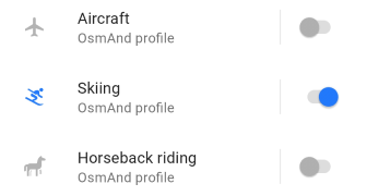
Vaya a: Menú → Configuración → Perfiles de la aplicación
Vaya a: Menú → Configuración → [object Object]
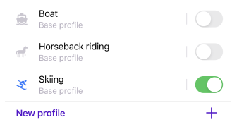
Los estilos de mapa de invierno y esquí se pueden habilitar en cualquier perfil. But it is most valuable in the Skiing profile, where it is set by default. The Skiing profile is very comfortable for the Skiing navigation.
Estilo de mapa de esquí
Utilice la leyenda del mapa de esquí para cualquier referencia. Ayuda a identificar los tipos de pistas en el mapa, así como los tipos de vías aéreas y otras características que se pueden leer en el mapa.
Al leer el mapa, puede averiguar los detalles que son importantes para usted, como la dificultad de una pista en particular, el tipo de pista, si se realiza la preparación y si la pista está iluminada por la noche.
Las opciones descritas aquí están disponibles en la navegación de esquí. The Skiing navigation sets the individual route options, which apply only to skiing.
El mapa de esquí de OsmAnd está construido como uno de los estilos de renderizado, that determines which objects to show on the map and the appearance of objects. All rendering styles are described in the Rendering.xml file. For the rules that define the internal structure of the XML file, see the Rendering documentation.
Pistas por dificultad
| Color | Descripción |
|---|---|
 | Verde - Pista para principiantes |
 | Azul - Colinas fáciles |
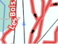 | Rojo - Pistas intermedias |
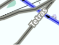 | Gris - Pistas de dificultad avanzada |
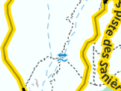 | Amarillo - Pistas de dificultad experta |
La dificultad de las pistas generalmente se indica con colores específicos. The colors may be different in different countries and resorts. Below are some practical guidelines.
For more specific guidance for each trail difficulty type, see the OSM piste difficulty reference or any other source that also considers slopes, obstacles, and hazards. In Winter and Ski map style, certain mapped hazards (for example avalanche-prone areas tagged as hazard=avalanche) may be shown as hazard POI on the map and should be taken into account together with piste difficulty.
Pistas por tipo
Las pistas difieren por tipo. A type represents different characteristics for a piste to meet the requirements of different winter-related activities: alpine skiing, classic skating, snowboarding, sled riding, backcountry skiing, ski touring, mogul skiing, night skiing, etc. Understanding the type of the piste on the map helps to build an optimal navigation route.
-
Pista de esquí alpino/descenso.
Utilizado para la navegación de esquí. This piste type has direction and difficulty, and most often it is surrounded by the boundaries of the ski resort. When a downhill piste is selected for Ski navigation, the direction of the piste is taken into consideration. If the Departure and the Destination points are established opposite to the direction of the piste, the navigation goes along the nearest aerial way. -
Pista de esquí nórdico/de fondo.
También se utiliza para la navegación de esquí. This piste type has no difficulty, may or may not have a direction, and most often goes beyond the boundaries of the ski resort. When navigating along this type of pistes, the Departure and Destination points often can be switched. -
Pista de esquí de travesía.
A menudo utilizada por los esquiadores para un ascenso nórdico y un descenso. The difficulty of a ski touring piste is often marked with the respective color. The Ski navigation can build a route along this type of piste, which allows you to combine the piste types. -
Otras pistas de esquí.
Tipos de pistas como Senderos de senderismo o Pistas de trineo se pueden utilizar para perfiles de esquí o senderismo.
Preparación de pistas
- Android
- iOS
Vaya a: Menú → Configurar mapa → Renderizado del mapa → Detalles → Pista de entrenamiento
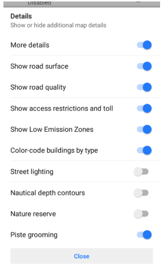
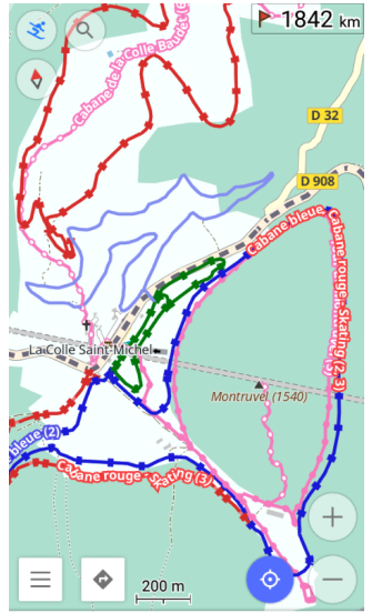
Vaya a: Menú → Configurar mapa → Estilo del mapa → Detalles → Pista de entrenamiento
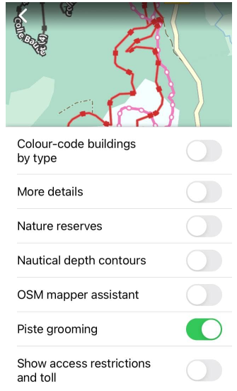
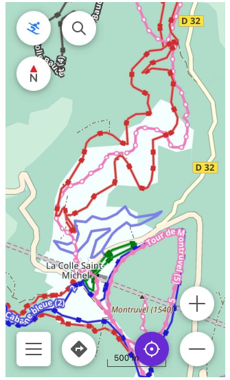
Para comprobar en el mapa si una pista en particular está preparada, debe habilitar la opción Pista de entrenamiento en la lista Detalles abierta desde el menú Configurar mapa.
Special machines groom the tracks to prepare them for the appropriate activity, such as classic skating, ice skating, and others. The same piste can be groomed differently in different areas.
Rutas de pistas de esquí
- Android
- iOS
Vaya a: Menú → Configurar mapa → Rutas → Pistas y rutas de esquí
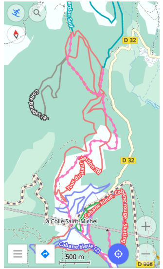
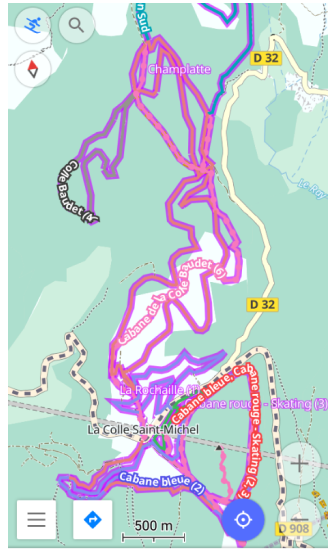
Vaya a: Menú → Configurar mapa → Rutas → Pistas y rutas de esquí
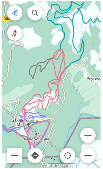
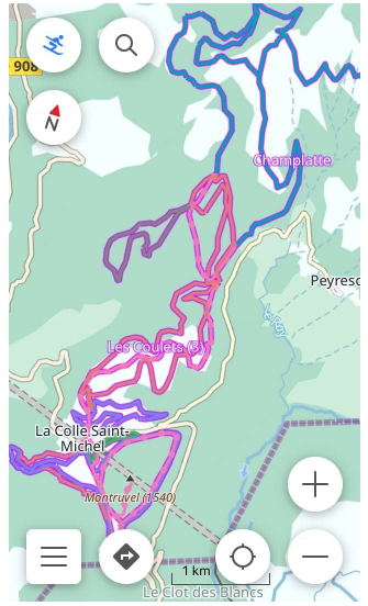
Para saber por qué pistas fuera de la estación de esquí puede navegar, debe habilitar la opción Pistas y rutas de esquí en la lista Rutas, abierta desde el menú Configurar mapa.
With the Skiing profile, the ski navigation and the Winter and Ski map style enabled, the Ski slopes and routes show all types of pistes that the Ski navigation can use to build navigation routes along. Such ski slope routes, if enabled, are outlined with the violet color mostly outside ski resort boundaries.
When enabling the option Ski slopes and routes for a map style other than Winter and Ski, only the slopes are displayed. Other ski-related features might not be shown in this styling layer.
Las Pistas y rutas de esquí son clicables.
Noche e iluminación
- Android
- iOS
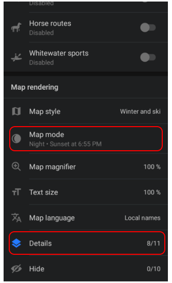
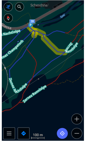
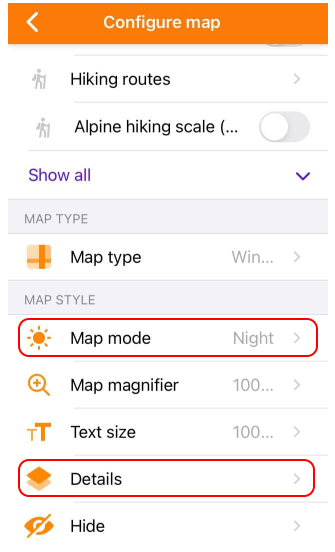
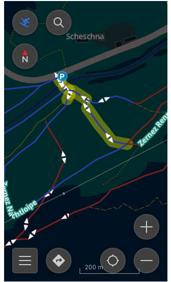
El estilo Invierno y esquí se puede usar con el modo Noche o Amanecer/atardecer. A comfortable choice for those who prefer dark colors, or darkening the screen at night, as well as for those who practice night skiing. Together with the Night mode, OsmAnd Ski Maps also can show which pistes have lighting with the Street Lighting option.
Both options are in the Configure map menu.
-
To enable the Night mode option, scroll down the list:
Menú → Configurar mapa → Modo del mapa -
To enable the Street Lighting option, open the list Detalles and activate the option:
Menú → Configurar mapa → Detalles → Alumbrado público