Boat routing
Overview
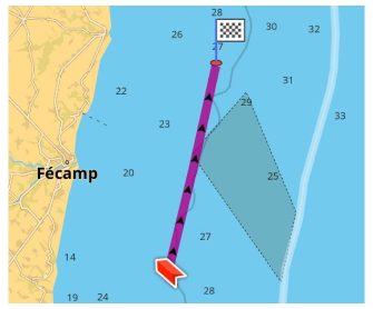
Boat routing can be a valuable tool for anyone who enjoys boating or sailing by channels, rivers or fairways. Due to lack of most Fairways in OpenStreeetMap data, the boat routing is not recommended for open water navigation, it is suggested to use Direct to point instead. With Depth contour lines enabled, it can help you stay safe on the water by avoiding hazards such as shallow waters, rocks, or other obstacles.
The OsmAnd Boat routing engine also takes into account the characteristics of the waterways and the boat themselves.
- Android
- iOS
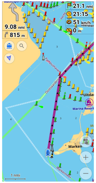
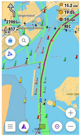
Route Parameters - Boat
By default, Boat profile is deactivated. To use this profile for routing, you need to switch it on in Menu → Settings → App profiles.
Boat routing can be configured according to your needs in the Route parameters section of the Navigation settings.
Typically, Boat routing is used with boat profile (the last one enabled together with the Nautical plugin). However, it is possible to use boat routing with other profiles as well, and different routing types can also be employed in the boat profile.
- Android
- iOS
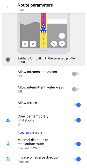
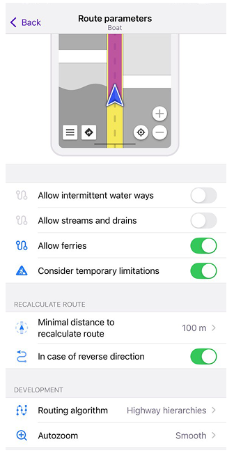
| Parameter | Description | Note |
|---|---|---|
| Allow streams and drains | Allows you to use streams and drains for boat navigation. Enabling this option may be useful for small boats such as canoes, kayaks, rafts, rowboats. | Streams are naturally-forming waterways that are too narrow to be called a river. Drains are artificial waterways, typically lined with concrete or similar, used to carry superfluous water like storm water or grey-discharge. |
| Allow intermittent water ways | Turning this option on allows you to use intermittent waterways to navigate by boat. | Tag Intermittent is used to indicate that a waterway does not permanently contain water. |
| Allow ferries | Enables routing via ferry routes. | Usually ferry routes are inaccessible for small boats based on OSM definition. |
-
The Boat profile is designed for routing along rivers, lakes, and other waterways. It supports OSM tags such as:
waterway=riverwaterway=canalnatural=water, etc.
-
The Boat profile also support ferry routes (
route=ferry) when the Allow ferries option is enabled. This means that if ferry routes are present on the map, they will be used when calculating boat routes. -
If no suitable waterways or ferry routes are mapped in OSM, the routing engine may not be able to construct a proper route. In such cases, you can use the Plan a Route tool and place waypoints manually.
Other Routing Types for Boat
Boat routing type is a default routing algorithm for Boat profile. Although you can choose another routing type, which is also suitable for boat navigation:
It's important to note, that the Direct-to-point and Straight line routings types should only be used in open water where there are no obstacles or hazards to navigation. If you are navigating in a waterway with a specific channel or route, you should use the boat routing type in OsmAnd, which will guide you through the correct navigational channels and avoid shallow areas or other hazards. Some mapped hazards based on OSM hazard=* tags may be shown on the map as hazard POI icons or text labels.
These routing types for the boat profile can be activated using the following path: Menu → Settings → Configure profile (Boat or another one) → Navigation settings → Navigation type.
Direct-to-Point Routing for Boat
When using Direct-to-point and Boat navigation types, you will need Depth contours data, which can be enabled and set in Configure map.
The Direct-to-point routing type can be used with the boat profile when you want to navigate your boat in open water without following any specific route or waterway. This routing type allows you to set a destination point and OsmAnd will calculate a direct path to that point from your current location. This type of routing doesn't consider the characteristics of your boat such as minimum and maximum speeds, height and width. Your route will not be recalculated in case of deviation.
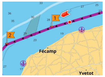
Straight Line Routing for Boat
The Straight line routing type can be used with the boat profile when you want to navigate your boat in open water but prefer to follow a straight line rather than a curved route to your destination point. This can be useful when navigating to a distant point, that is visible on the horizon, for example.
