Nautical Map Style
Default OsmAnd map style, part of Nautical plugin.
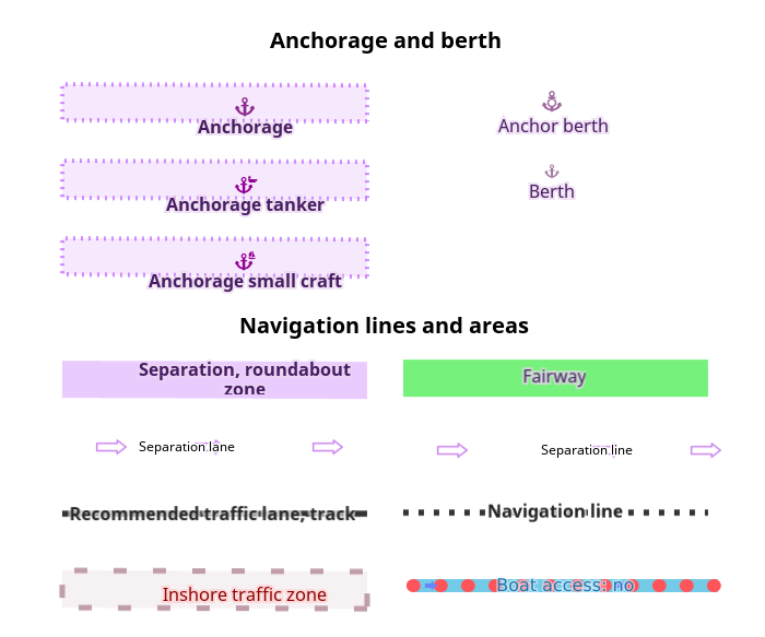
For nautical navigation. Features buoys, lighthouses, riverways, sea lanes and marks, harbors, seamark services, and depth contours.Anchorage and berth
Buyos and beacons
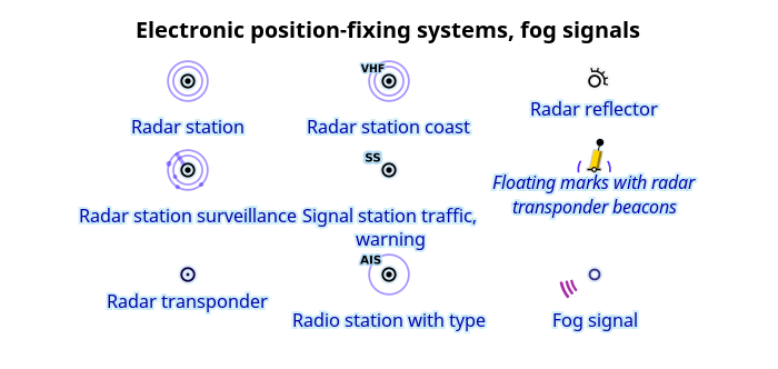
Electronic position
Electronic position-fixing systems, fog signals
Lights

Ports, moorings
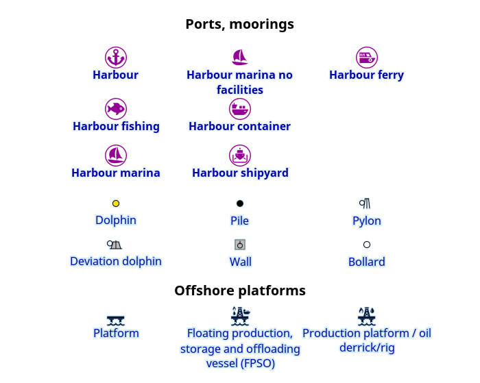
Ports, moorings
Offshore platforms

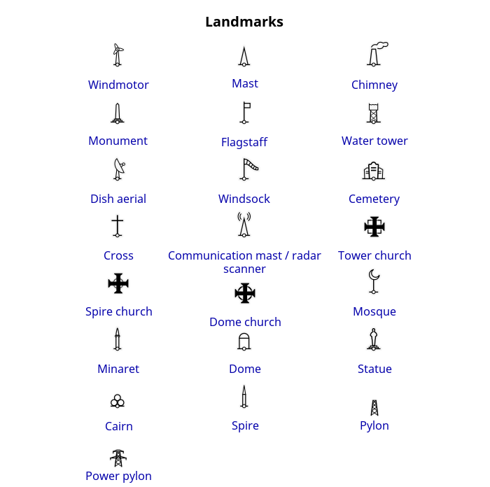
Landmarks
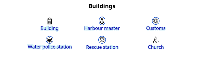
Buildings
Wrecks and rocks
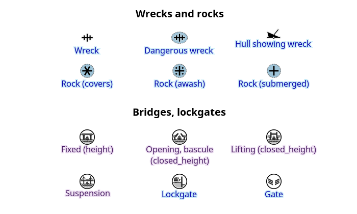
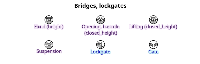
Bridges lockgates
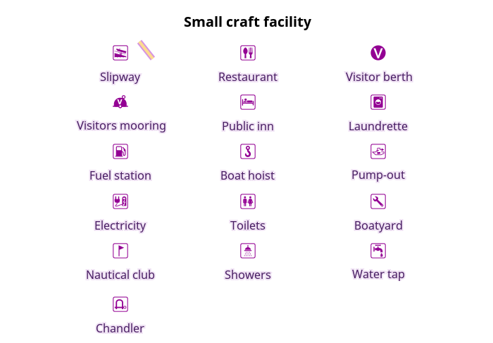
Nautical small craft facility
Nautical others

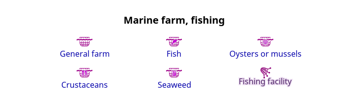
Marine farm, fishing
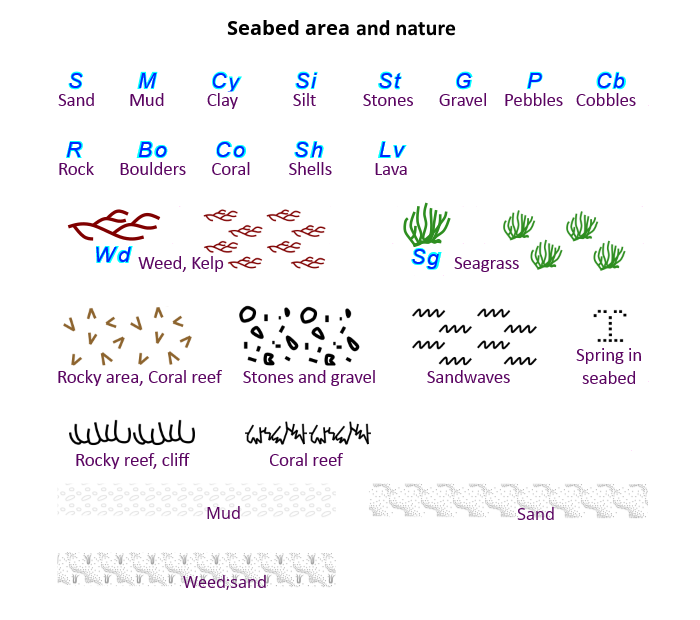
Seabed area
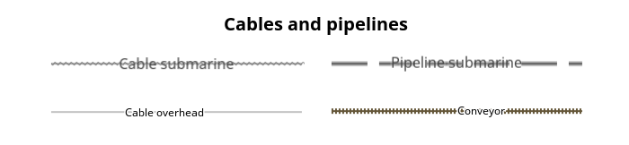
Cables and pipelines
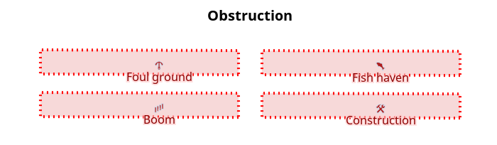
Obstruction
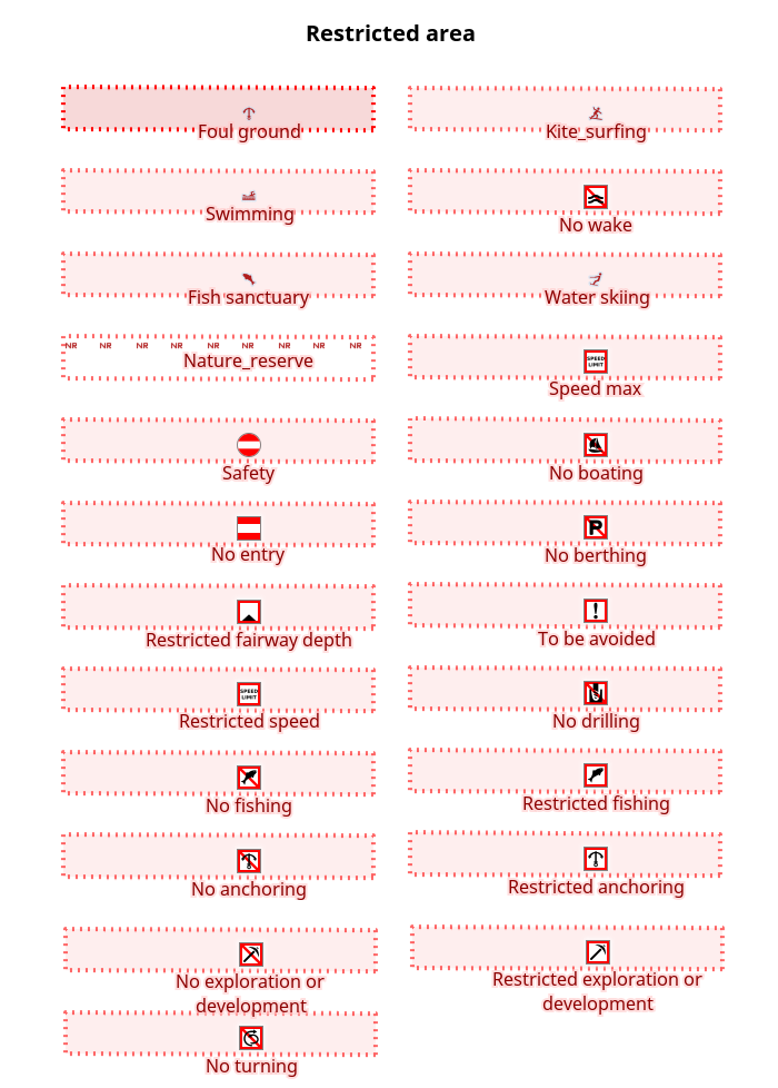
Restricted area
Precautionary area
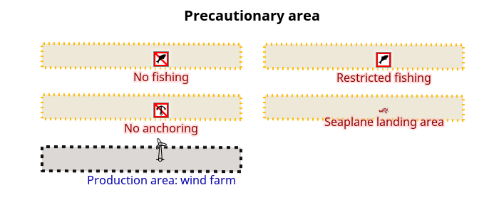
Precautionary area
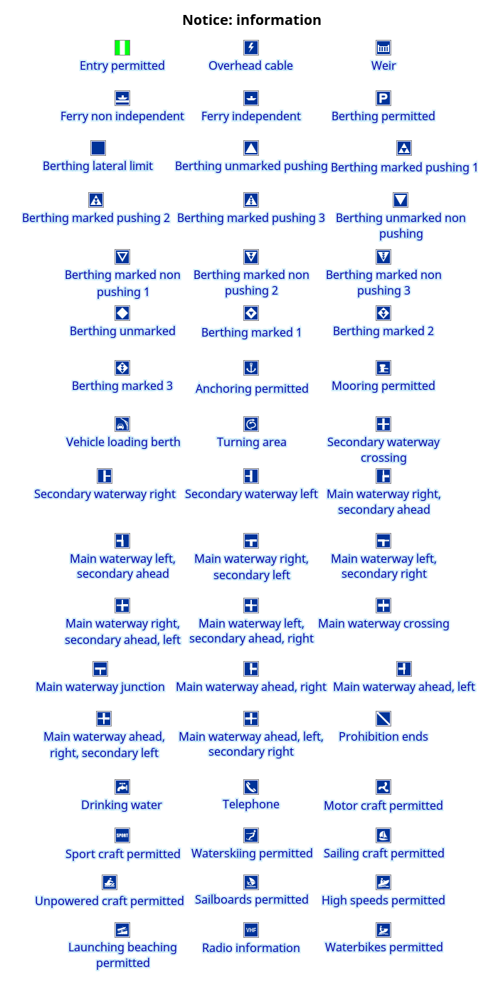
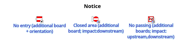
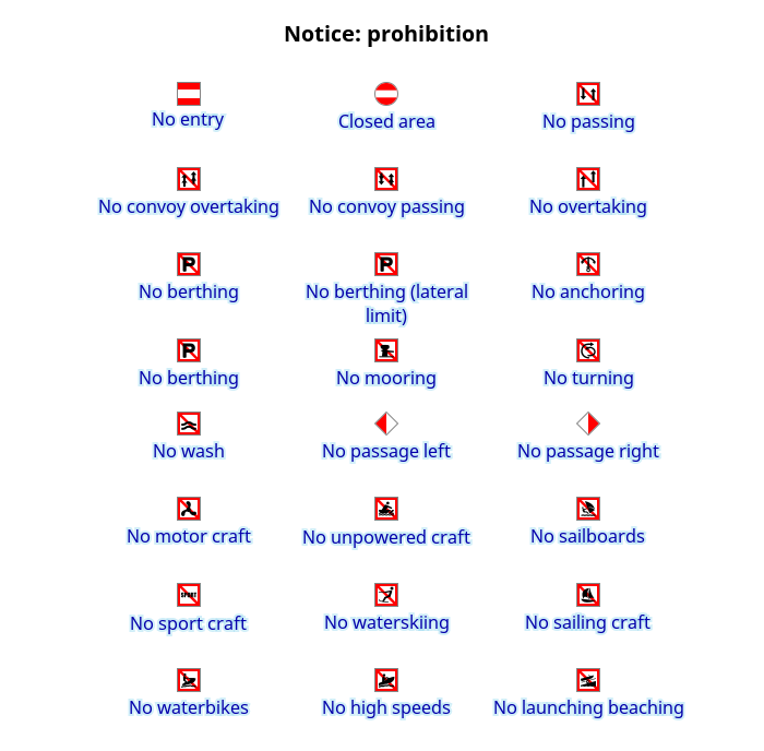
Notice
Notice: prohibition
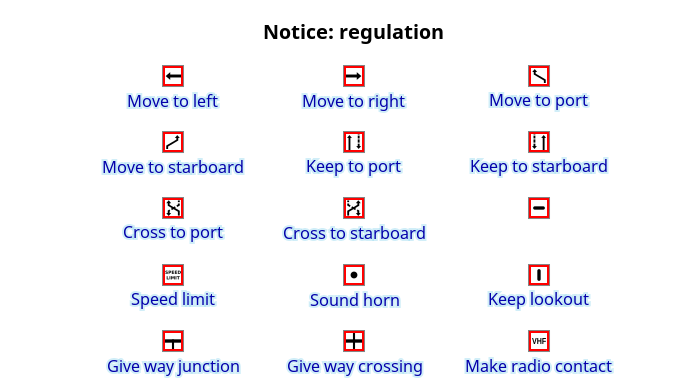
Notice: regulation
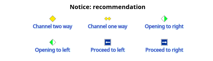
Notice: recomendation
Notice: information