OsmAnd 4.7 (iOS)

Hello Everyone,
We're delighted to share some exciting news with you! OsmAnd version 4.7 for iOS devices is now officially available. This latest update brings a host of new features and improvements that we can't wait for you to try.
You can download the update right now from the AppStore. Added new widgets, improved user interface, and several performance upgrades that make OsmAnd even better.
What's new
- Redesign Tracks menu
- Widget settings updates
- Tracks menu of Configure map
- Updates of GPX tracks
- 3D visualization
- External sensors data for Analize on map
- Additional tags support
- Sun position widget
- Glide ratio widget
- Round up numbers
- Vertical exaggeration
- OsmAnd Cloud updates
- Basemap app language
- Missing maps download
- More
Redesign Tracks menu
We've completely redesigned the Tracks menu in My Places.
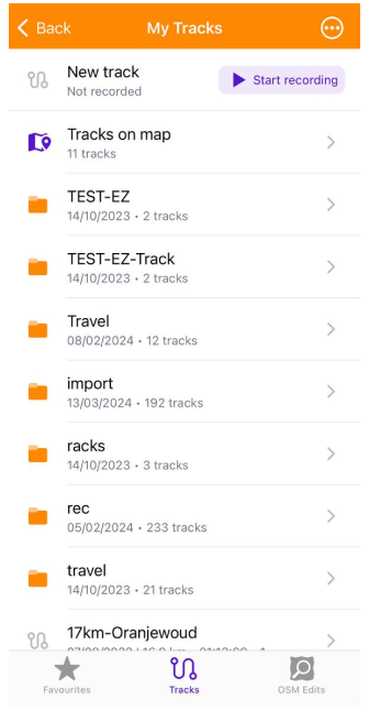
Tracks on map folder now directly opens the Tracks menu in Configure map.
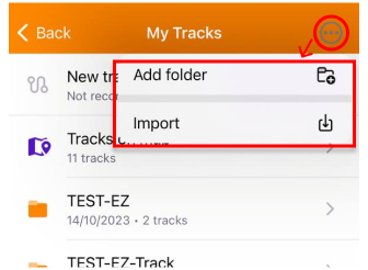
By tapping the 3-dot button, you access a menu with the following actions:
- Add folder allows you to create and name a new folder.
- Import enables the importation of a GPX file.
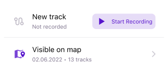
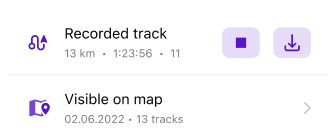
New track allows to start Trip recording action. Just click "Start recording" button. During the recording, you can view the Recording track data, including distance, duration, and the number of waypoints. There are two key actions available during recording: Stop record and Save GPX track.
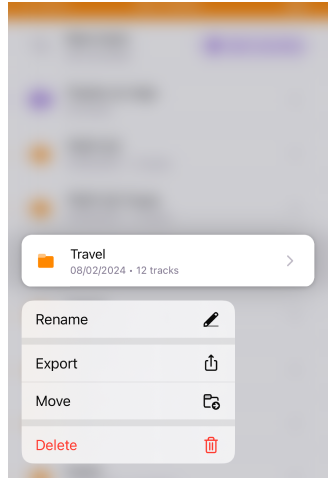
A long press on any folder opens the Folder menu, which includes the following options:
- Rename lets you rename the selected folder.
- Export enables you to export the folder as an OSF file.
- Move provides the option to relocate a folder to another Tracks folder or to create a new folder for moving the selected folder into it.
- Delete gives you the ability to remove the selected folder.
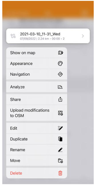
A long press on any GPX track brings up a menu with the following options:
- Show on map displays the selected track on the map.
- Navigation starts navigation using the track.
- Analyze launches Analyse on map.
- Share allows you to share the selected track.
- Upload modifications to OSM enables you to upload changes to OpenStreetMap.
- Edit opens the selected track in Plan a route for editing.
- Duplicate provides the option to create a copy of the selected track.
- Rename lets you change the name of the selected track.
- Move allows you to relocate the selected track to a specified folder.
- Delete gives you the option to remove the selected track.
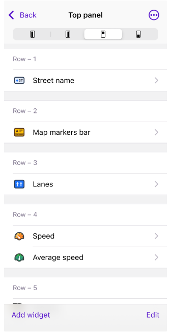
Widgets updates
-
Enhanced top and bottom widget panels to accommodate all widgets.
-
Background color opacity for transparency widget mode.
-
Improved widget configuration by allowing users to move pages and rows.
Redesign Tracks menu of Configure map
Enhanced management of tracks displayed on the map:
iOS Menu → Configure map → Show on map → Tracks
We've introduced two sections: Visible and All
- In Visible, you can select and deselect tracks to be displayed on the map and choose from a "Recently Visible" section.
- In All, you have the option to select tracks from the complete track list.
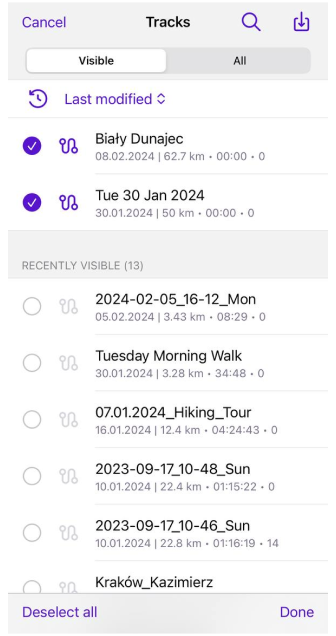
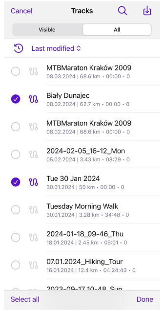
You can utilize the following actions (buttons) for track management:
- 🔍 Magnifying glass for seaching a track from the track list.
- 📥 import a track from device.
- "Select All" - select all tracks from the list.
- "Done" - done your track selections and close the "Tracks" section.
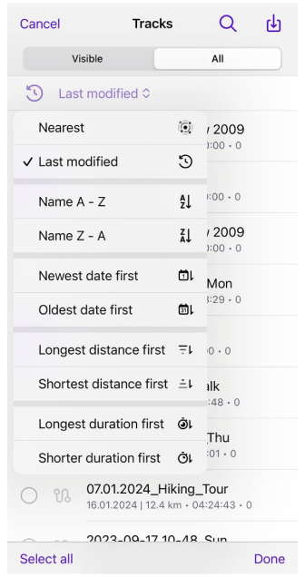
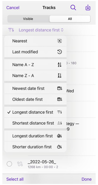
By clicking on "Last modified" you access the Sort tracks menu. Here, you can organize your tracks by:
- "Nearest" or "Last modified"
- "Name A-Z" or "Name Z-A"
- "Newest date first" or "Oldest date first"
- "Longest distance first" or "Shortest distance first"
- "Longest duration first" or "Shorter duration first"
Updates of GPX tracks
3D visualization
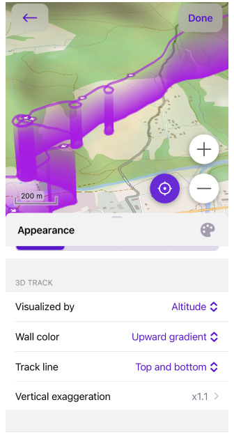
Introduced 3D visualization for tracks based on altitude (it's a paid feature of Maps+):
Track Context menu → Change Appearance → 3D TRACK
- Visualized by: Altitude, Fixed height.
- Wall color: Solid, Downward gradient, Upward gradient.
- Track line: Top, Bottom, Top and bottom.
- Vertical exaggeration: None to x3.0
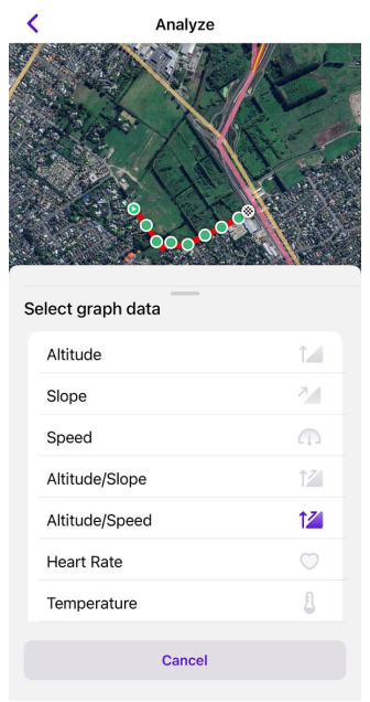
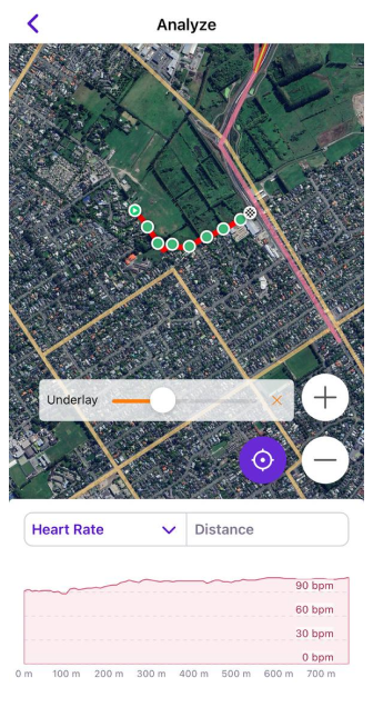
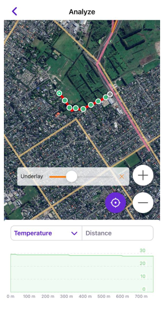
External sensors data for Analize on map
Updated "Analyze on Map" feature to include the capability to display metrics from sensors.
- You can now analyze your track data alongside external sensors data: choose the track → Options → Analyze on map → Select graph data
Additional tags support
-
Enhanced tags support for GPX has been implemented, including
link,author,copyright, andkeywords. -
Added support for additional tags for OSM routes (tourist routes):
description,from,to,distance,direction,state,colour,ascent,descent,roundtrip,tourism
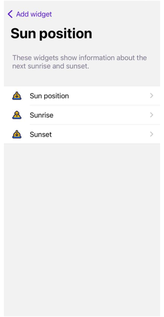
Sun position widget
A new Sun position widget has been added, complementing the Sunrise and Sunset widgets. This section of widgets is now named "Sun position":
Menu → Configure screen → Widgets → Add widget → Sun Position → Sun position, Sunrise, Sunset.
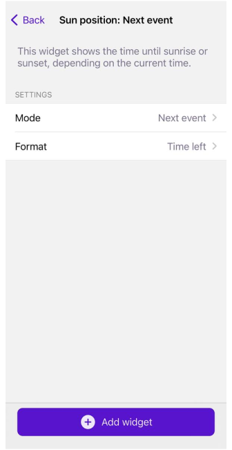
"Sun Position" widget displays the time until sunrise or sunset, based on the current time. This widget offers the following settings:
- Mode: Select from "Next event", "Sunset", "Sunrise".
- Format: Choose between "Time left" or "Next event". These format settings can be adjusted by tapping the widget on the screen.
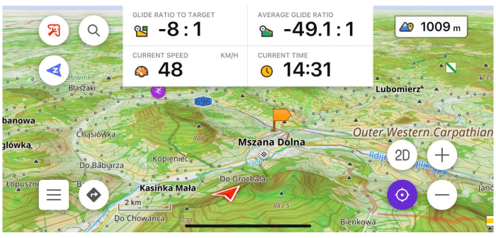
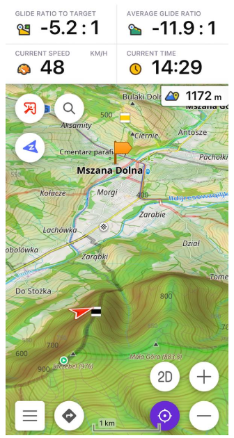
Glide ratio widget
Simple Glide Ratio widgets have been introduced for use in aircraft. These widgets display the glide ratio to the target or the average glide ratio for the current flight.
OsmAnd menu → Configure screen → Widgets (All panels) → Glide ratio to target/Target elevation and Average glide ratio/Average vertical speed
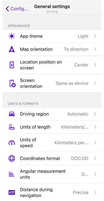
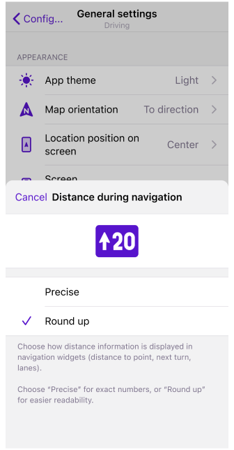
Round up numbers in navigation widgets
You can now select the format for displaying distance information in navigation widgets, like distance to a point, the next turn, and lanes. Choose "Precise" for exact figures or "Round up" to enhance readability with simpler, rounded numbers:
Menu → Settings → Navigation Profile → General settings → Units & formats → Distance during navigation → Precise or Round up
Vertical exaggeration
A special coefficient for 3D relief has been added in this release. Now, you can adjust the Vertical Exaggeration:
iOS Menu → Configure map → Terrain → Vertical exaggeration (Ensure that 3D relief is enabled)
This feature allows you to view the contours of smoother topography with enhanced detail.

OsmAnd Cloud updates
-
OsmAnd Cloud: added ability to restore deleted files from Trash.
-
OsmAnd Cloud: added ability to delete account.
App Language for Basemap
The World Basemap now adopts the language of the app for naming, aligning with the app's language settings. This is applicable for base map zoom levels 1-6 (less than 7 map zoom). The app language can be modified in the System settings under OsmAnd Maps – Language.
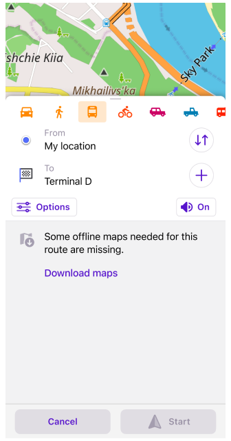
Missing maps download
OsmAnd now alerts you if some maps between your start point and destination are missing. It's important to ensure that all maps are up to date and of the same release date for a consistent navigation experience.
More
Tasks resolved in OsmAnd 4.7 include:
- Fixed the "Coordinates" widget where, in some cases, the last digits were missed.
- Fixed "3D Mode" button behavior: tapping on the button doesn't save the tilt angle.
- Fixed status bar color for older iOS versions.
- Fixed rotate and pinch to zoom gestures and Overlay/Underlay sliders for Mac OS version.
- Improved Autozoom animation for navigation.
- Roundabout with exit number shown on CarPlay when navigating.