OsmAnd 4.4 (iOS)

Hi there!
We are glad to announce that iOS app version development does not stand still. The new improved version is already available to install on you devices!
Thank you for your support and feedback.
The minimum iOS version is increased to 15.0.
Please, upgrade your iOS to 15.0 version before OsmAnd installation.

What's news:
What's new
- Minimum iOS version
- Wikipedia updates
- Search for Favorites
- CarPlay updates
- Hiking routes
- Update OpenStreetMap Plugin
- Improved privacy
- Map orientation update
- Map ruler update
- Widgets updates
- External input devices
- More
Minimum iOS version
Minimum iOS version is increased to 15.0. Please, upgrade your iOS to 15.0 version before OsmAnd installation.
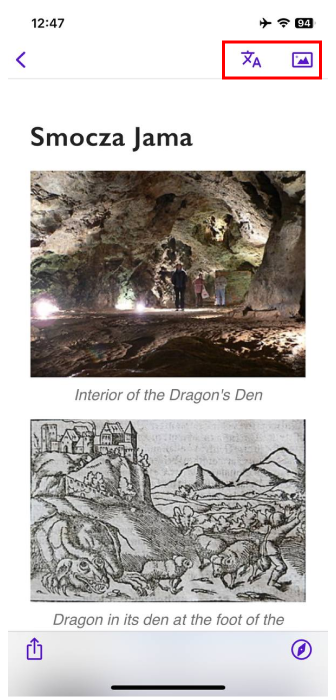
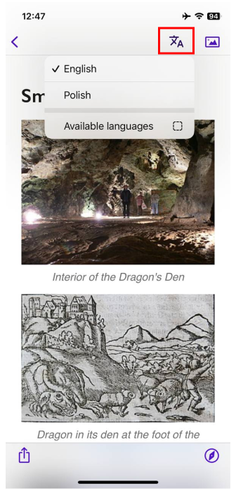
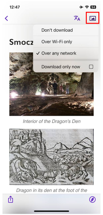
Wikipedia updates
- The Plugin Wikipedia settings is profile dependent:
Menu → Settings → App Profiles → Plugins → Wikipedia
Here you can choose languages in which Wikipedia articles will appear on the map. Choose download or not images and set cache size for images.
-
Added Wikipedia article images for the Context menu.
-
Added Download images menu and Change language menu.
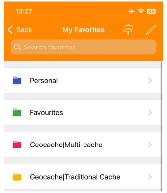
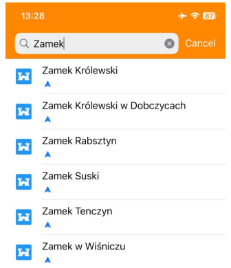
Search for Favorites
Added the search bar for Favorites menu: Menu → My Places → Favorites → Pull down
 |  |
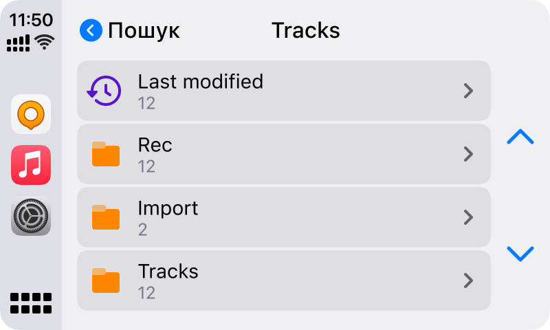
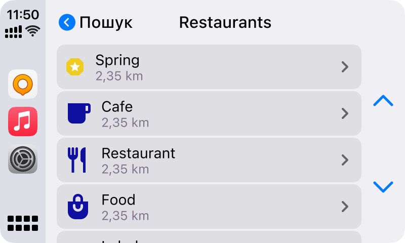
CarPlay updates
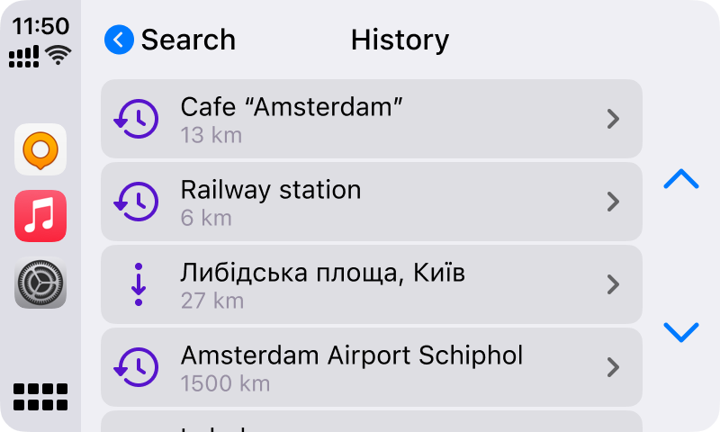
-
added search history and the recent route in the menu:
-
reorganized tracks and favorites list (items visible in the list - 24 items by order newest):
-
device display with navigation info:
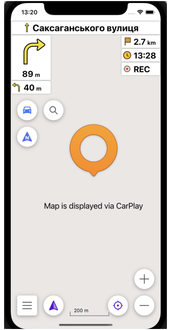
-
showing the map on CarPlay Dashboard.
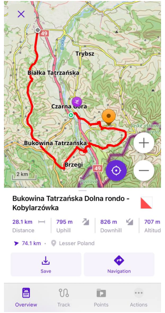
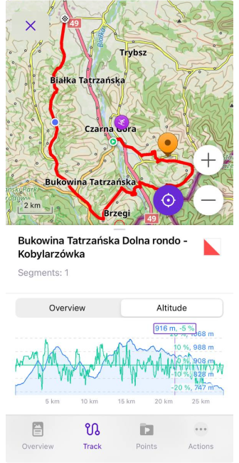
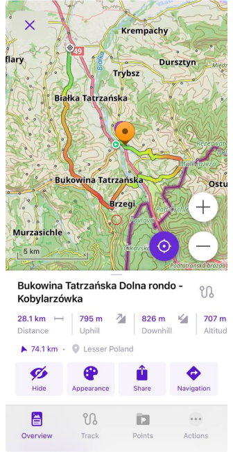
Hiking routes
Added ability to select routes on the map for viewing additional information or starting navigation by the chosen route. Just tap hiking routes on the map to open the Track Context menu:
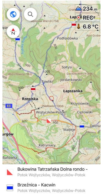 |  |
Available to start navigation by a track ÷or download it.
 |  |
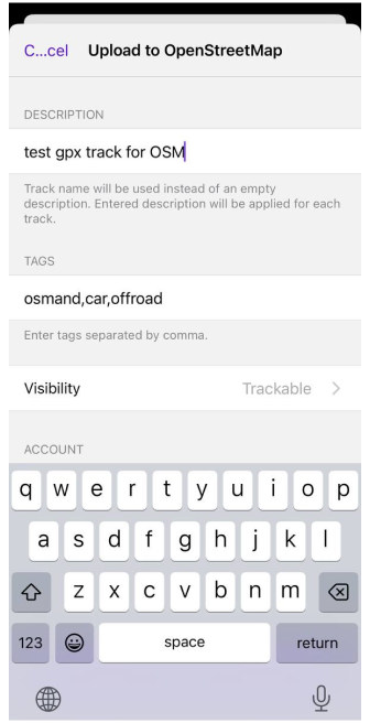
Update OpenStreetMap Plugin
Added ability to upload GPX tracks to OpenStreetMap project:
Track Context menu → Actions → Upload to OpenStreetMap
 |
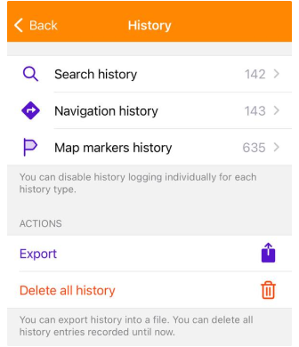
Improved privacy
Added options to disable history logging:
Menu → Settings → OsmAnd settings → History
 |
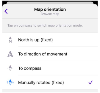
Map orientation update
Added manually rotated mode:
Menu → Settings → App Profile → General settings → Map orientation → Manually rotated (fixed)
 |
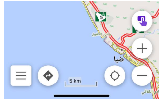
Map ruler update
Improved visibility of the map ruler:
-
Decrease top/bottom padding for text label.
-
Added Stroke for the ruler.
Widgets updates
Added Coordinates: map center widget, Developer widgets, and Sunset and sunrise widgets:
Menu → Configure screen
 |  |  |
External input devices
For this release, we added the opportunity for using external input devices. Read more here.
More
Dynamic type fot text
Added "Dynamic type" support, text size in OsmAnd will change accordingly to text size in iOS.
Speed camera alerts
Added legal warning about using speed camera alerts.
Voice prompts
Added support for new languages: Catalan, Ukrainian, Bulgarian, Indonesian, Slovenian.
UI improvements
UI improvements for RTL languages.
Accessibility
Added content labelling for map buttons.
New Profile
Added the "Moped" profile.
Tracks
- Tracks start to be visible on the map from 200 km zoom, even if they more then 3000 km long.
- Currently recorded track appear in the menu after recording stops.
- Import of Garmin GPX Tracks: Track Extensions are attributed to the wrong Track.
Follow OsmAnd on Facebook, TikTok, X (Twitter), Reddit, and Instagram!
Join us at our groups of Telegram (OsmAnd News channel), (EN), (IT), (FR), (DE), (UA), (ES), (BR-PT), (PL), (AR), (TR).
