OsmAnd 4.4 (Android)

Great news for Android users!
We're happy to announce the new 4.4 OsmAnd release for Android devices.

What's news:
- Improved "Tracks" menu in "Configure Map",
- Context menu now displays localized names for POI,
- Added option to share route by link,
- Map orientation added new fixed mode,
- Added "Display position" menu,
- Simplified start screen,
- Added "Speed/Slope" graph for track analysis,
- Added "Nautical miles/feet" unit of length,
- The App language on Android 13,
- Downloading online tiles used as "Overlay" or "Underlay" maps,
- Imperial measurement units for "Vehicle parameters",
- Moped profile,
- Simulate location redesign,
- Bugs fixs:
- Fixed bugs with Android Auto.
- Fixed issues with displaying Vegan places.
- Fixed map gestures.
- Fixed Australian roads shields.
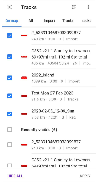
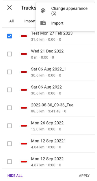
Tracks menu
"Tracks" menu has a new design and more simple UX. It's easy to choose a needed track for showing it on the map, change appearance (⋮ more than one track) or make an import (⋮):
OsmAnd menu > Configure map > Tracks
 |  |
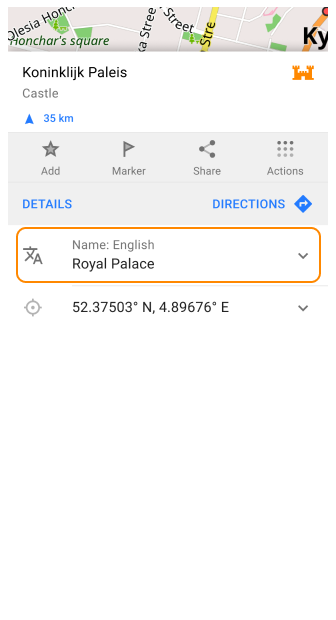
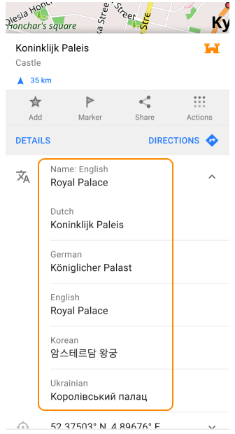
Localized POI names
Added localized POI names for Map context menu. Click on the POI name to open the full name list.
 |  |
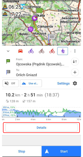
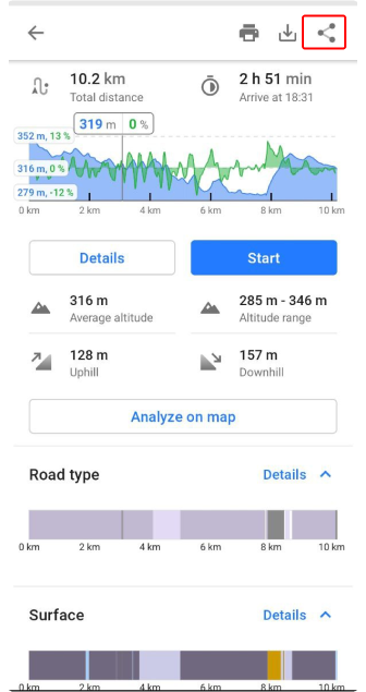
Route link
After route creation in OsmAnd you can generate and send a link.
Navigation context menu > Details > Share button
 |  |
 | 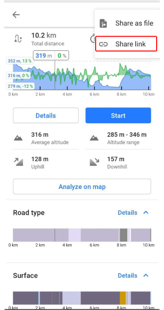 |
Route link for example: https://osmand.net/map?start=50.212845%2C19.831682&end=50.141838%2C19.883652&mode=pedestrian#10/49.816523/19.846590
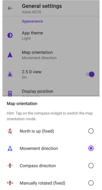
Map orientation
Added new fixed mode for Map orientation:
- Manually rotated (fixed)
 |
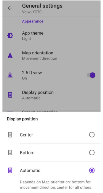
Display position
Added the new settings for "Display position":
Menu → Configure profile → General settings→ Display position
Here you can choose three variants of your location on the screen map:
- Center: use center screen position for the cursor ("My location"),
- Bottom: use bottom screen position for the cursor ("My location"),
- Automatic: bottom for movement direction, center for all others.
 |
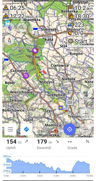
Simplified Start screen
Restructure the Start screen. Now there is an opportunity to open OsmAnd Cloud.
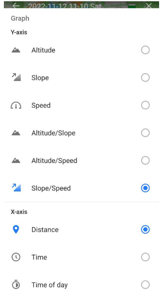
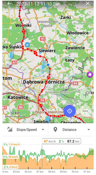
Speed/Slope graph
Added Slope/Speed mode for Analyze track on the map.
 |  |
Nautical miles and feet
Added "Nautical miles/feet" for Units & formats.
App language for Android 13
Added support for OsmAnd language preferences (Android 13):
App info (OsmAnd) > App languages
Downloand Overlay/Underlay maps
Added possibility to download online tiles used as "Overlay" or "Underlay" maps:
Map Context menu → Actions → Download map
Download/update tiles menu will be opened.
Imperial measurement
Added support of imperial measurement units for "Vehicle parameters".
Open Menu → Settings → Profile → General settings → Driving region → USA
Now, you can choose inches for Vehicle parameters: Menu → Settings → Profile → General settings → Navigation settings → Vehicle parameters
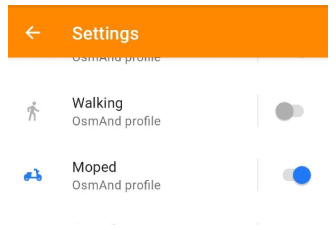
Moped profile.
Added new profile - Moped. It uses a "moped" routing profile, has a bicycle as a parent, and is disabled by default.
 |
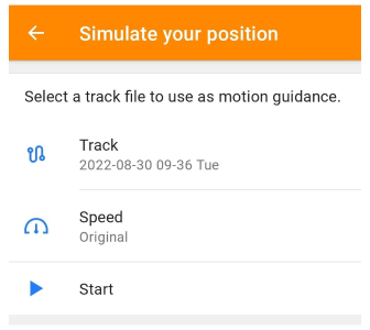
Redesign Simulate location
We redesigned "Simulate your position" by adding a new screen with settings.
 |
Bugs fixs
Android Auto
- the issue: movement direction map orientation is flipped and jiggles,
- the split-screen issue,
- fixed crash with GPX selection,
- the issue with the Navigation info panel,
- added support Android Auto map mode: Day, Night, Automatic.
Vegan places POIs
Fixed the issue: "Most vegan places don't show".
Map gestures
Fixed map gestures for tilt, zoom and rotation:
Australian roads shields
Fixed Australian roads shields.
Follow OsmAnd on Facebook, TikTok, X (Twitter), Reddit, and Instagram!
Join us at our groups of Telegram (OsmAnd News channel), (EN), (IT), (FR), (DE), (UA), (ES), (BR-PT), (PL), (AR), (TR).

