Terrain maps

· 7 min read
Eugene
Marketing lead

Hello everybody!

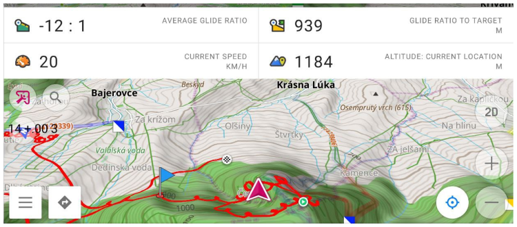
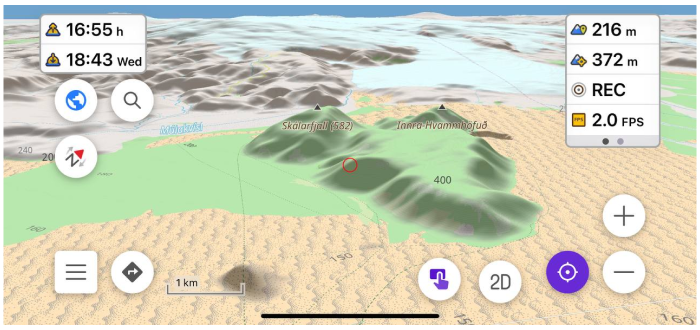
In the OsmAnd 4.5 release, a new terrain map type has been added. This is a new data type in our application, which is needed for terrain rendering, and for some additional functions related to elevations. All the information is in our documentation, but in this article, we will describe how and what you can see and get on the screen with a new data type.

☛ Let's go!

OsmAnd 4.5 (Android)

· 7 min read
Eugene
Marketing lead

Good news, everybody! Revolutionary changes we made in 4.5 OsmAnd release for Android devices. Go ahead and read all what was added and improved.

Big Spoiler:

  • OsmAnd Cloud backup for Favorites, OsmAnd Settings and OSM Notes going free
  • New Terrain format and 3D relief
  • New Track management menu
  • BLE sensors
  • Train profile..

banner_android_4

Raster maps

· 3 min read
Eugene
Marketing lead

Hello everybody!

This article is about one of the general OsmAnd killer-feature - Online maps plugin. This Plugin allows us to enable and add other map sources for OsmAnd. All of these sources are raster maps.

Raster maps come from various sources and they complement OpenStreetMap data, and sometimes they are the only source. By combining map layers, you can get the best picture on your screen:

  • Android
  • iOS

Custom map styles

· 2 min read
Eugene
Marketing lead

Hello everybody!

In this article, we want to show you how OsmAnd users create their own map styles.

OsmAnd map styles

At first about Map styles by default.

OsmAnd contains own 10 map rendring styles: OsmAnd, Touring view, UniRS and LightRS, Nautical, Winter and ski, Topo, OSM-carto, Desert, Offroad, Snowmobile.

Android version: Menu → Configure map → Map rendering → Map style

iOS version: Menu → Configure map → Styles for offline maps

OsmAnd Map styles

OsmAnd 4.4 (iOS)

· 7 min read
Eugene
Marketing lead

Hi there!

We are glad to announce that iOS app version development does not stand still. The new improved version is already available to install on you devices!

Thank you for your support and feedback.

note

The minimum iOS version is increased to 15.0.

Please, upgrade your iOS to 15.0 version before OsmAnd installation.

iOS 4.4

Terrain on the map

· 5 min read
Eugene
Marketing lead

Hi Everybody!

OsmAnd has the ability to display terrain offline in a variety of ways: contour lines, hillshades, slopes, altitude graphs..

Hiking

2023 New Year resolutions

· 7 min read

Happy New Year!

We have a good tradition every end of the year to write down New Year Resolutions for the next year and sum up the results of the past year (Resolutions 2022). It's already our 6th Resolutions.

2022 was very difficult for our team though we stayed strong and #StandWithUkraine 🇺🇦. Nevertheless, there is quite a lot to be proud of 2022 achievements.

In 2022 we launched the new OsmAnd website with new documentation and map. We also introduced the Pro cross-platform subscription for iOS, Android, Web and finally released OpenGL Rendering for Android with 3D terrain.